


Westport 10km
Point-by-Point Route Description
10KM
Start Time: 8.45am
Please note route and start time are subject to change
The route starts in the car park beyond the soccer pitch at the end of Romain Island, at the end of Westport Quay, with beautiful views over Clew Bay and the surrounding area. The route will be marked with BLUE KM markers and directional markers for competitors. There will also be BLUE paint road markings for each km. Busy junctions and other key areas will be marshalled. The route is primarily flat, with a total overall elevation of 97m spread throughout the route. Competitors run toward Westport Quay, turning right around the pond at the Helm junction onto the L1801 (1k).
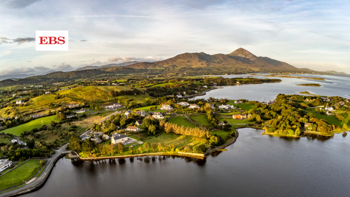
Pass The Towers pub and follow the road before turning left at the Quay School/Bus Eireann depot and then turning right onto the Westport Railway walk. A slight drag along parts of the Railway walk, running towards Westport town until a right turn before the low bridge at approx (3k) mark. Turn right after 50m onto the walkway running adjacent to the R335 Louisburgh Road. With great views out to Croagh Patrick, run along the walkway, past the marshalled junction at Ardmore and Cloghan (4k). Be sure to follow the indented path just beyond the 5km mark at Aughavale Cemetery, before turning right at the marshalled junction (Belclare) just after the 6km mark. A full road closure is in place along the L1801 from Belclare Junction (6k) to the Ardmore Junction (9k approx) so please use the width of the road. Passing the 6km marker, running downhill back towards Westport Quay, a full road closure opens the width of the road to runners. Please obey marshal instructions in the case of meeting local traffic.
With the waters of Clew Bay to your left as you pass 7km, run along the footpath, passing the Sheebeen pub on your right before turning immediately left to complete the short loop of Rosbeg, just after the 8km mark. Rejoining the L1801 (9k), turn right and you are now running downhill, passing the Bus Eireann depot again (9.5k), before running back towards the Towers bar. Turn immediately left at the Towers, run along the slip road to the finish line at the end of the road adjacent to the car park.
